 |
|
| Tour du Soleil - Swiss/Italian frontier |
| 7 days skiing Maximum
Group Size See also: |
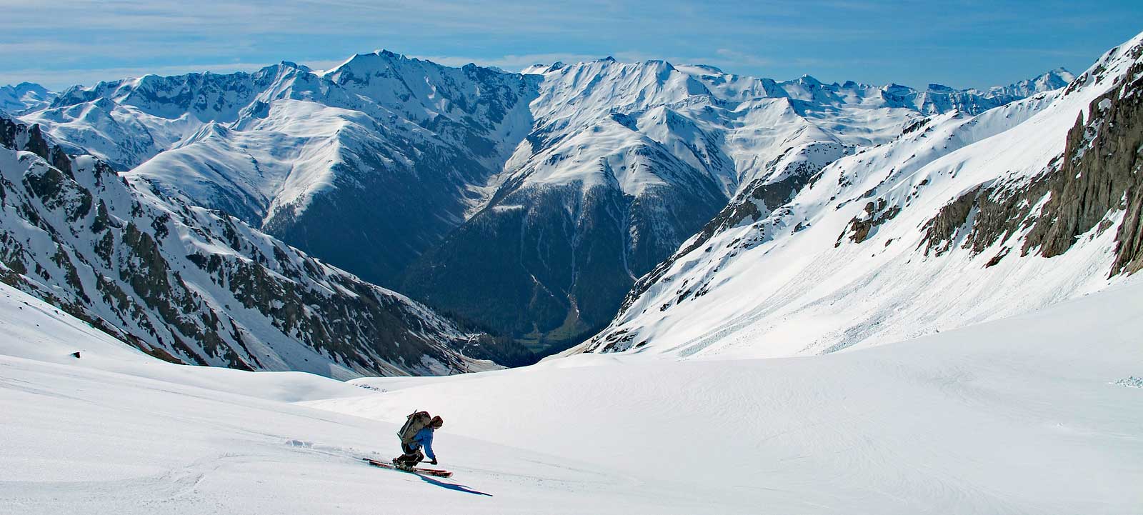
Everyone knows Switzerland is full of mountains, but, for most of us, our attention centers on the famous peaks in the Valais or the Berner Oberland – the Matterhorn, Eiger and their neighbors. But there are countless alternative mini-massifs that offer arguably better ski touring possibilities. One of these is the group of mountains just south of the Berner Oberland. Slicing right through the middle of Switzelrand, running east-west, is the great gash formed by the Rhône and the Rhien rivers. North of this line are the Bernese Alps (north of the Rhone) and the Glarus Alps (north of the upper Rhein). To the south of the upper Rhein are the string of peaks which form the backbone of the Tour du Soleil. This tour passes from Switzerland into Italy and then back to the Swiss side. For us, this means super-comfy Italian huts (the coffee simply is better, and the wine less expensive) and more sun (usually). The glaciers here are smaller, and more managable, allowing us to travel in some weather conditions that would be impossible in the mountains to the north. The terrain is complex, with numerous passes and mini-valleys, giving us lots of options for different routes and variations. To get a sense of the miriade of options, have a look at the Swiss mapping site map.geo.admin.ch. Click on the link in the upper left "Looking for more maps?". Type in "ski routes" and, under "Add Map..." choose "Ski Routes". Zoom into the middle of the country and find Andermatt, almost in the center, due south of Zurich, close to Italy. Our tour follows a west to east line in the peaks SW of Andermatt. If you want to get fancy, and see the route plan, download this GPX track, and upload it into the site (choose "Advanced Tools" then "Import"). Tour highlights:
|
|
 |
|
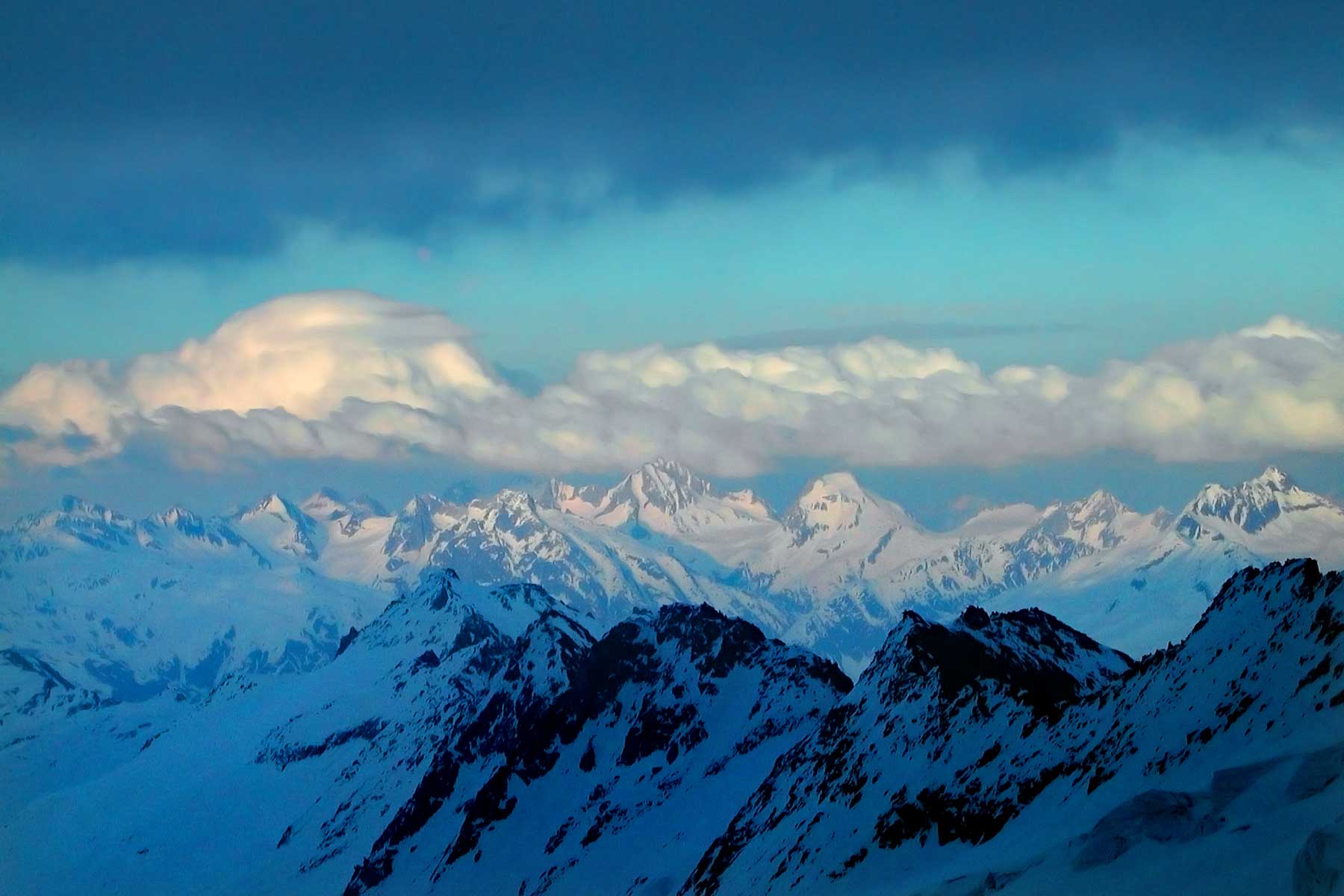
| Our last day passes between the two big peaks in the center, crossing in front, from right ot left, of the left-hand, highest summit. | |
| Tour du Soleil Itinerary | |
| Day 0 | We rendezvous in Andermatt. This central Switzerland town is easy to reach and a great base to add more days of skiing to your holiday. From Zurich airport the train takes about 2 hours and 40 minutes. Geneva airport is about twice that. We'll meet in the early evening. |
| Day 1 | We start this tour with a day's skiing in Andermatt. Not only is a "warm-up" day a good way to get over jet lag, it is a good way to recover left luggage (should you be so unfortunate) as well as revise our touring kit as needed. Our preference here is to spend the day on the incomparable Gemsstock. Served by a quick cable car, the Gemsstock rises some 1500 meters (5000 feet) above Andermatt. There are numerous possible routes from which to choose, some require skins and other just bare skis. We stay the a second night in Andermatt. |
| Day 2 | On day 2 our goal is the Binntal hut. We start with the train to Fiesch, and then the bus into the Binn valley. Normally we can ride the bus all the say to Fäld at 1550 meters. The start of the walk in is on a south and southwest facing hill side, so there is a good chance we'll have to carry our skis. But in a good snow year it won't be long at all to reach snow. The Binntal hut has been very recently remodeled. Traditionally, the hut has been non-guarded for the winter season. But even if the guardian is absent the facilities are excellent, and we have full access to cooking stoves and pots, and beds and blankets. There is even a beer and wine supply with an honor payments system.
|
| Day 3 | On to the Margaroli hut and into Italy! There are several possibilies for this day. If conditions are not ideal there is a southern route, that passes to the south of the Punta d'Arbola (Ofenhorn), over the Albrunpass, then the Scatta Minoia pass. If weather and ski/avalanche conditions are good, we may opt to ski northeast to the Passo del Sabbione, crossing onto the large glacier that flows down the north side of Punta d'Arbola. We can climb steeply to the summit at 3236 meters. This is the classic ski peak of the area. On descent we ski down to the Passo del Vannino and Lago Vannino below. The hut is just next to the dam on this same lake. The Margaroli hut is very well equipped, with showers, wifi and lovely italian coffee.
|
| Day 4 | From the Maragoli hut, we continue north, steeply up over the Passo di Nefelgui then down the narrow valley to more open slopes in the Vallone de Nefelgui. We continue down into the valley before tackling the rather unfortunate 430 meter climb up to the Rifugio Maria-Luisa. Like the Margaroli, the Maria-Luisa hut is very comfortable, again with full ammenities (including showers!).
|
| Day 5 | Day 5 is a bit more difficult, with some steep terrain, both up and down. With a bit of luck we'll be able to climb the Basodino, the other "not-to-be-missed" summit of the area (at least according to CamptoCamp.org). We begin with a steep climb up to the Kastellüke, Where we pass back into Switzerland. From the pass (lücke) we descend a very short way then traverse onto the glacier of the north slopes of the Basodino. At about 2930 meters we cross over onth the Basodino Glaicer proper and then up to the summit, the last part on foot. A long ski descent, some 1400 meters, leads us to the Capanna Basodino.
|
| Day 6 | Day 6 is a wild and complicated day as we weave our way though complex terrain before a long descent to the Bedretto valley. Again the day has a bit of a sting in its tail, as we climb 340 meters up to the Piansecco hut.
|
Day 7 |
The day begins wiht a big 800 meter climb up to the Passo Rotondo, the gateway between the Chüebodenhorn and Pizzo Rotondo. We travers high around the north side of Pizzo Rotondo, the up to the Witenwasserenpass. Then its down the Witenwasserengletscher (I just had to write that) before a short climb up to the Rotondo hut, and lunch. But our goal for the day loes below, and it is almost all downhill to Realp. From Realp we hope on the train and are back in Andermatt in about 15 minutes.
|
| Skills Required |
This tour requires a high level of fitness and very good skiing abilities. On most of days the total elevation gained is over 1000 meters (3300 feet). Being in good shape will ensure you have enough energy to manage (and have great fun as well!) on the long descents which follow. The reason that skiing skills must be at an advanced to expert level has more to do with the conservation and expenditure of energy over a long day than the absolute technical difficulty of the skiing. There are several steep sections, but for the most part the slopes are not overly steep. The challenge comes in managing poor snow conditions (heavy wet snow, crud or breakable crust) and not losing too much energy or risking injury in the process. Great skiers look like they are hardly working, and this is in fact the case. If your skiing is not up to par you will spend far, far more energy than a better skier. By way of comparison, the Tour du Soleil has generally steeper skiing, both up and down, than the Silvretta or Albula tours. It is technically comparable to the Ortler, Berner Oberland or Chamonix to Zermatt Haute Roued trips. Ski skills required;
Skiers who regularly enjoy black or double black runs in most western American ski areas should do fine. If you like to get off the piste and into the crud, ski the trees, and in general look for the steeper shots, you'll probably have a great time on this tour. If you tend to stick to the groomed slopes and find the wild untracked a bit intimidating you should think twice about this option. We will likely encounter all different kinds of snow, from the best to the worst, and you need to have sound, energy-efficient strategies to cope with them. A good gauge of your ability can be found in mogul skiing. If you are good in the bumps and seek them out, then you most likely have developed the rhythm and balance needed for steep or difficult snow. You must be able to ski moderate bumps in good conditions, skiing rhythmically and fluidly, following a line near the fall line with good speed control. If you have any doubt about your ability to manage the skiing on this tour, please contact us to see if we can answer your questions. The Tour du Soliel also includes lots of uphill kick turns, occasionally on moderately steep terrain. Though we will most likely do a quick review of this important skill, you should have some facility with it prior to joining us. Previous mountaineering skills are useful, but not required. If you are a good skier, you will not have difficulty picking up new skills, as you will already be comfortable on steep slopes. |
 |
Kathy Cosley & Mark Houston AMGA Certified • SNGM members All images, layout and text ©2015 Cosley & Houston Alpine Guides, All Rights Reserved |
|